Jamnik, Vrhnika
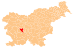
Place in Inner Carniola, Slovenia
45°58′49.09″N 14°14′27.53″E / 45.9803028°N 14.2409806°E / 45.9803028; 14.2409806 Slovenia
Jamnik (pronounced [ˈjaːmnik]) is a small settlement in the hills west of Vrhnika in the Inner Carniola region of Slovenia.[2]
History
Jamnik became a separate settlement in 2002, when its territory was administratively separated from Zaplana.[3]
References
External links
- Jamnik on Geopedia
- v
- t
- e
Municipality of Vrhnika
Administrative seat: Vrhnika
- Bevke
- Bistra
- Blatna Brezovica
- Drenov Grič
- Jamnik
- Jerinov Grič
- Lesno Brdo
- Mala Ligojna
- Marinčev Grič
- Mirke
- Mizni Dol
- Padež
- Podlipa
- Pokojišče
- Prezid
- Sinja Gorica
- Smrečje
- Stara Vrhnika
- Strmica
- Trčkov Grič
- Velika Ligojna
- Verd
- Zaplana
- Zavrh pri Borovnici
- Ivan Cankar
- Karel Grabeljšek
- Simon Ogrin
- Jožef Petkovšek
- Matej Sternen


