Retovje Springs

Retovje Springs is a group of springs that join to form the Big Ljubljanica River (Slovene: Velika Ljubljanica).
Name
The name Retovje and names like it (e.g., Retje, Dolnje Retje) are derived from the Slovene common noun retje 'powerful karst spring' from the root *vrětje 'springing, gushing'.[1][2] The generic term okence in the Slovene name of two springs at the site is a diminutive of the common noun okno (literally, 'window') in the secondary meaning 'spring, place where groundwater surfaces'.[2][3]
Geography

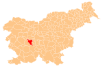
The springs are located in the Retovje Valley, a steephead valley near Verd south of Vrhnika. The springs include:
- Walnut Spring (Pod Orehom)
- Cliff Spring (Pod skalo, Pod steno)
- Big Spring (Veliko okence)
- Little Spring (Malo okence)
Big Spring and Little Spring are the two most powerful springs in the group. After almost 1 km, the Big Ljubljanica joins the Little Ljubljanica (Slovene: Mala Ljubljanica) to form the Ljubljanica River.
Exploration
The karst springs and sumps at Retovje were first studied in 1939 by the Kuščer brothers.[4] Big Spring has been explored to a length of 270 m and a depth of 25 m, and Little Spring to a length of 305 m and depth of 45 m.[4]
References
- ^ Snoj, Marko. 2003. Slovenski etimološki slovar. 2nd edition. Ljubljana: Modrijan, p. 353.
- ^ a b Pavlovec, Rajko. 2006. "Domači kraški izrazi z Ljubljanskega barja." Geografski vestnik 78(1):61–64.
- ^ Bezlaj, France. 1982. Etimološki slovar slovenskega jezika, vol. 2. Ljubljana: Slovenska akademija znanosti in umetnosti, p. 245.
- ^ a b Retovje. DEDI - Enciklopedija naravne in kulturne dediščine na Slovenskem. (in Slovene)
External links
- Retovje Springs on Geopedia
 Media related to Retovje Springs at Wikimedia Commons
- v
- t
- e
Municipality of Vrhnika
Administrative seat: Vrhnika
- Bevke
- Bistra
- Blatna Brezovica
- Drenov Grič
- Jamnik
- Jerinov Grič
- Lesno Brdo
- Mala Ligojna
- Marinčev Grič
- Mirke
- Mizni Dol
- Padež
- Podlipa
- Pokojišče
- Prezid
- Sinja Gorica
- Smrečje
- Stara Vrhnika
- Strmica
- Trčkov Grič
- Velika Ligojna
- Verd
- Zaplana
- Zavrh pri Borovnici
- Ivan Cankar
- Karel Grabeljšek
- Simon Ogrin
- Jožef Petkovšek
- Matej Sternen
45°57′04″N 14°17′45″E / 45.951060°N 14.295935°E / 45.951060; 14.295935
 | This Slovenian geography article is a stub. You can help Wikipedia by expanding it. |
- v
- t
- e


