Atoyac de Álvarez (municipality)
Municipality in the Mexican state of Guerrero
You can help expand this article with text translated from the corresponding article in Spanish. (January 2023) Click [show] for important translation instructions.
- Machine translation, like DeepL or Google Translate, is a useful starting point for translations, but translators must revise errors as necessary and confirm that the translation is accurate, rather than simply copy-pasting machine-translated text into the English Wikipedia.
- Do not translate text that appears unreliable or low-quality. If possible, verify the text with references provided in the foreign-language article.
- You must provide copyright attribution in the edit summary accompanying your translation by providing an interlanguage link to the source of your translation. A model attribution edit summary is
Content in this edit is translated from the existing Spanish Wikipedia article at [[:es:Municipio de Atoyac de Álvarez]]; see its history for attribution. - You may also add the template
{{Translated|es|Municipio de Atoyac de Álvarez}}to the talk page. - For more guidance, see Wikipedia:Translation.
Municipality in Guerrero, Mexico

Coat of arms
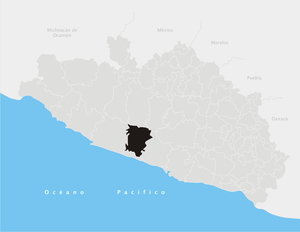
Municipality of Atoyac de Álvarez in Guerrero
 Mexico
 (2020)
Atoyac de Álvarez is a municipality in the Mexican state of Guerrero. The municipal seat lies at Atoyac de Álvarez. The municipality covers an area of 1,638.4 km2 (632.6 sq mi).
Geography
Atoyac is located on the Costa Grande of the state of Guerrero, about 84 kilometers (52 mi) west of the port of Acapulco, which is the main city of the state. It has an area of 1,638.4 km2 (632.6 sq mi). It limits to the north with San Miguel Totolapan, Ajuchitlán del Progreso and General Heliodoro Castillo; to the east with Coyuca de Benítez; to the west with Tecpan de Galeana and to the south with Benito Juárez. The extreme coordinates of the municipality are 17 ° 03 '- 18 ° 32' north latitude, and 100 ° 05 '- 100 ° 34' west longitude.
In 2020, the municipality had a total population of 60,680,[1] up from 58,452 in 2005.[2]
References
- ^ "Atoyac de Álvarez: Economy, employment, equity, quality of life, education, health and public safety". Secretaría de Economía. Retrieved 9 November 2023.
- ^ "Atoyac de Álvarez". Enciclopedia de los Municipios de México. Instituto Nacional para el Federalismo y el Desarrollo Municipal. Archived from the original on September 30, 2007. Retrieved December 23, 2008.
- v
- t
- e
 State of Guerrero
Chilpancingo (capital)
and
(municipal seats)
- Acapulco de Juárez (Acapulco)
- Acatepec (Acatepec)
- Ajuchitlán del Progreso (Ajuchitlán)
- Ahuacuotzingo (Ahuacuotzingo)
- Alcozauca de Guerrero (Alcozauca de Guerrero)
- Alpoyeca (Alpoyeca)
- Apaxtla (Apaxtla de Castrejón)
- Arcelia (Arcelia)
- Atenango del Río (Atenango del Río)
- Atlamajalcingo del Monte (Atlamajalcingo del Monte)
- Atlixtac (Atlixtac)
- Atoyac de Álvarez (Atoyac de Álvarez)
- Ayutla de los Libres (Ayutla de los Libres)
- Azoyú (Azoyú)
- Benito Juárez (San Jerónimo de Juárez)
- Buenavista de Cuéllar (Buenavista de Cuéllar)
- Chilapa de Álvarez (Chilapa de Álvarez)
- Chilpancingo de los Bravo (Chilpancingo de los Bravo)
- Coahuayutla de José María Izazaga (Coahuayutla de Guerrero)
- Cochoapa el Grande (Cochoapa el Grande)
- Cocula (Cocula)
- Copala (Copala)
- Copalillo (Copalillo)
- Copanatoyac (Copanatoyac)
- Coyuca de Benítez (Coyuca de Benítez)
- Coyuca de Catalán (Coyuca de Catalán)
- Cuajinicuilapa (Cuajinicuilapa)
- Cualac (Cualac)
- Cuautepec (Cuautepec)
- Cuetzala del Progreso (Cuetzala del Progreso)
- Cutzamala de Pinzón (Cutzamala de Pinzón)
- Eduardo Neri (Zumpango del Río)
- Florencio Villarreal (Cruz Grande)
- General Canuto A. Neri (Acapetlahuaya)
- General Heliodoro Castillo (Tlacotepec)
- Huamuxtitlán (Huamuxtitlán)
- Huitzuco de los Figueroa (Huitzuco)
- Iguala de la Independencia (Iguala de la Independencia)
- Igualapa (Igualapa)
- Ixcateopan de Cuauhtémoc (Ixcateopan de Cuauhtémoc)
- Iliatenco (Iliatenco)
- José Joaquín de Herrera (Hueycantenango)
- Juan R. Escudero (Tierra Colorada)
- Juchitán (Juchitán)
- La Unión de Isidoro Montes de Oca (La Unión)
- Las Vigas (Las Vigas)
- Leonardo Bravo (Chichihualco)
- Malinaltepec (Malinaltepec)
- Marquelia (Marquelia)
- Mártir de Cuilapán (Apango)
- Metlatónoc (Metlatónoc)
- Mochitlán (Mochitlán)
- Ñuu Savi (Coapinola)
- Olinalá (Olinalá)
- Ometepec (Ometepec)
- Pedro Ascencio Alquisiras (Ixcapuzalco)
- Petatlán (Petatlán)
- Pilcaya (Pilcaya)
- Pungarabato (Ciudad Altamirano)
- Quechultenango (Quechultenango)
- San Luis Acatlán (San Luis Acatlán)
- San Marcos (San Marcos)
- San Miguel Totolapan (San Miguel Totolapan)
- San Nicolás (San Nicolás)
- Santa Cruz del Rincón (Santa Cruz del Rincón)
- Taxco de Alarcón (Taxco de Alarcón)
- Tecoanapa (Tecoanapa)
- Tecpan de Galeana (Tecpan de Galeana)
- Teloloapan (Teloloapan)
- Tepecoacuilco de Trujano (Tepecoacuilco de Trujano)
- Tetipac (Tetipac)
- Tixtla de Guerrero (Tixtla de Guerrero)
- Tlacoachistlahuaca (Tlacoachistlahuaca)
- Tlacoapa (Tlacoapa)
- Tlalchapa (Tlalchapa)
- Tlalixtaquilla de Maldonado (Tlalixtaquilla)
- Tlapa de Comonfort (Tlapa de Comonfort)
- Tlapehuala (Tlapehuala)
- Xalpatlahuac (Xalpatlahuac)
- Xochihuehuetlan (Xochihuehuetlan)
- Xochistlahuaca (Xochistlahuaca)
- Zapotitlán Tablas (Zapotitlán Tablas)
- Zihuatanejo de Azueta (Zihuatanejo)
- Zirándaro (Zirándaro de los Chávez)
- Zitlala (Zitlala)


