Zgornji Velovlek
Place in Styria, Slovenia
46°28′22.31″N 15°54′34.59″E / 46.4728639°N 15.9096083°E / 46.4728639; 15.9096083 Slovenia
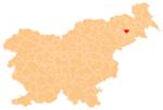
 (2020)
Zgornji Velovlek (pronounced [ˈzɡoːɾnji ʋɛˈloːu̯lɛk]) is a settlement in the Municipality of Destrnik in northeastern Slovenia. The area is part of the traditional region of Styria. The municipality is now included in the Drava Statistical Region.[2]
There is a small chapel-shrine with a wooden belfry on the regional road from Ptuj to Lenart v Slovenskih Goricah in the settlement. It dates to the early 20th century.[3]
There are a number of Roman-period burial mounds in the area of the settlement.[4]
References
- ^ Statistical Office of the Republic of Slovenia Archived November 18, 2008, at the Wayback Machine
- ^ Destrnik municipal site
- ^ Slovenian Ministry of Culture register of national heritage Archived July 12, 2010, at the Wayback Machine reference number ešd 19987
- ^ Slovenian Ministry of Culture register of national heritage Archived July 12, 2010, at the Wayback Machine reference numbers ešd 6456 & 6457
External links
- Zgornji Velovlek on Geopedia
- v
- t
- e
Municipality of Destrnik