Yuyang District
You can help expand this article with text translated from the corresponding article in Chinese. (December 2008) Click [show] for important translation instructions.
- Machine translation, like DeepL or Google Translate, is a useful starting point for translations, but translators must revise errors as necessary and confirm that the translation is accurate, rather than simply copy-pasting machine-translated text into the English Wikipedia.
- Do not translate text that appears unreliable or low-quality. If possible, verify the text with references provided in the foreign-language article.
- You must provide copyright attribution in the edit summary accompanying your translation by providing an interlanguage link to the source of your translation. A model attribution edit summary is
Content in this edit is translated from the existing Chinese Wikipedia article at [[:zh:榆阳区]]; see its history for attribution. - You may also add the template
{{Translated|zh|榆阳区}}to the talk page. - For more guidance, see Wikipedia:Translation.
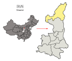
District in Shaanxi, People's Republic of China
Yuyang 榆阳区 | |
|---|---|
District | |
 Yuyang in Yulin | |
 Yulin in Shaanxi | |
| Country | People's Republic of China |
| Province | Shaanxi |
| Prefecture-level city | Yulin |
| Area | |
| • Total | 7,053 km2 (2,723 sq mi) |
| Population (2019) | |
| • Total | 575,100 |
| • Density | 82/km2 (210/sq mi) |
| Time zone | UTC+8 (China standard time) |
| Postal code | 719000 |
| Licence plates | 陕K |
Yuyang District (simplified Chinese: 榆阳区; traditional Chinese: 榆陽區; pinyin: Yúyáng Qū), is a district of Yulin, Shaanxi, China, bordering Inner Mongolia to the west.
Administrative divisions
As 2019, Yuyang District is divided to 6 subdistricts, 14 towns and 5 townships.[1]
- Subdistricts
|
|
- Towns
|
|
- Townships
|
|
See also
- Hongliutan, Zhenchuan, Yuyang
References
- ^ "统计用区划代码 www.stats.gov.cn" (in Chinese). XZQH. Retrieved 2021-01-02.
- v
- t
- e
County-level divisions of Shaanxi Province
| Xi'an |
|---|
| Tongchuan | |
|---|---|
| Baoji | |
| Xianyang | |
| Weinan | |
| Yan'an | |
| Hanzhong | |
| Yulin | |
| Ankang | |
| Shangluo |
38°12′19″N 109°39′14″E / 38.20528°N 109.65389°E / 38.20528; 109.65389
 | This Shaanxi location article is a stub. You can help Wikipedia by expanding it. |
- v
- t
- e


