Yorkdale–Glen Park
Neighbourhood in Toronto, Ontario, Canada
Yorkdale–Glen Park | |
|---|---|
Neighbourhood | |
 View of Glen Park from Glencairn Avenue and Allen Road | |
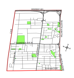 Map of Yorkdale–Glen Park (City of Toronto) | |
| Country | Canada |
| Province | Ontario |
| City | Toronto |
| Municipality established | 1850 York Township |
| Changed municipality | 1922 North York from York Township |
| Changed municipality | 1998 Toronto from North York |
| Population (2021)[1] | |
| • Total | 16,625 |
| • Density | 2,451/km2 (6,350/sq mi) |
Yorkdale–Glen Park is a neighbourhood in the city of Toronto, Ontario, Canada, located in the former suburb of North York. It is bounded by Highway 401 to the north, Allen Road to the east, a line south of Stayner Avenue to the south, and the CNR tracks to the west.
Character and demographics
For the most part, the homes in southern Yorkdale–Glen Park (south of Lawrence) tend to date back to the 1950s and 1960s, when developers perfected the uniform vista of bungalows and back splits. Southern Yorkdale–Glen Park is a middle-class suburban community of brick houses. Local shopping areas include Lawrence Plaza, Yorkdale Mall and various street shopping areas along Dufferin Street and Marlee Avenue.
The southern section of Yorkdale–Glen Park, centred on Dufferin Street, is home to a large Italian-Canadian population.
Northwest Yorkdale–Glen Park is primarily industrial, especially along Bridgeland Avenue, and commercial, with a concentration of outlet-style specialty stores especially around Orfus Road. There is a small residential swath bounded by Paul David Street to the west, Dufferin Street to the east, Bentworth Avenue to the south and Jane Osler Drive to the north.
Northeast Yorkdale–Glen Park (east of Dufferin, north of Lawrence) is part of Lawrence Heights.
Total population (2021): 16,625[1]
Major ethnic populations (2021):
- 48.5% White; 23.0% Italian, 8.2% Portuguese
- 10.2% Black; 2.9% Jamaican
- 8.5% Filipino
- 8.2% Latin American (of any ethnicity)
- 6.9% South Asian
- 6.2% Chinese
- 5.8% East Indian
Total population (2016): 14,804[2]
Major ethnic populations (2016):
- 52.0% White; 27.4% Italian, 9.8% Portuguese
- 9.9% Black; 5.2% Jamaican
- 7.7% Chinese
- 7.5% Filipino
- 6.6% South Asian
- 5.2% East Indian
- 4.8% Latin American (of any ethnicity)
Total population (2011): 14,687[3]
Major ethnic populations (2011):
- 56.0% White; 28.2% Italian, 7.7% Portuguese
- 10.7% Black
- 6.5% Chinese
- 6.5% Filipino
- 5.1% South Asian
- 4.9% Latin American (of any ethnicity)
Total population (2006): 14,430[4]
Major ethnic populations (2006):
- 59.6% White; 33.6% Italian, 5.7% Portuguese
- 11.3% Black; 4.3% Jamaican
- 6.9% Chinese
- 6.7% South Asian
- 5.9% East Indian
- 5.8% Filipino
- 4.3% Latin American (of any ethnicity)
Total population (2001): 13,520[5]
Major ethnic populations (2001):
- 67.6% White; 39.3% Italian, 4.0% Portuguese
- 7.3% Chinese
- 6.9% Black
- 5.1% East Indian
- 4.0% South Asian
- 3.4% Filipino
- 2.7% Latin American (of any ethnicity)
Education


Two public school boards operate elementary schools in Glen Park, the separate Toronto Catholic District School Board (TCDSB), and the secular Toronto District School Board (TDSB). Public elementary schools in the neighbourhood include:
- Joyce Public School (TDSB)
- Regina Mundi Catholic School (TCDSB)
- St. Charles Catholic School (TCDSB)
- Sts. Cosmas and Damian Catholic School (TCDSB)
TCDSB is the only public school board that operates a secondary school in the neighbourhood, Dante Alighieri Academy. TDSB does not operate a secondary school in the neighbourhood, with TDSB secondary school students residing in southern Yorkdale–Glen Park attending institutions in adjacent areas The French first language public secular school board, Conseil scolaire Viamonde, and it separate counterpart, Conseil scolaire catholique MonAvenir also offer schooling to applicable residents of Morningside, although they do not operate a school in the neighbourhood. CSCM and CSV students attend schools situated in other neighbourhoods in Toronto.
One private school serves the neighbourhood, Fieldstone Day School, established in 1997, boasts as Canada's only Cambridge School serving Junior kindergarten to Grade 12.[6] Fieldstone is housed in the former C.B. Parsons Junior High School, which once housed Seneca College's Yorkdale Campus.
Transportation

Several major roadways serve as the boundary for Glen Park, Lawrence Avenue to the north, and Bathurst Street to the east. Other major thoroughfares that pass through the neighbourhood include Dufferin Street, and Allen Road. The portion of Allen Road within Glen Park is used as a controlled access highway.
Public transportation is provided by the Toronto Transit Commission (TTC), operating several buses in the neighbourhood, as well as two stations for the Toronto subway, Glencairn, and Lawrence West station. Both stations provide access to Line 1 Yonge–University. Bus routes operated by the TTC include 14 Glencairn, 29 Dufferin, 47 Lansdowne, 52 Lawrence West, 59 Maple Leaf, and 109 Ranee.
References
- ^ a b "About Neighbourhood Profiles". City of Toronto.
- ^ "2016 Neighbourhood Profile Yorkdale–Glen Park" (PDF). City of Toronto. Retrieved 9 January 2019.
- ^ "2011 Neighbourhood Profile Yorkdale–Glen Park" (PDF). City of Toronto. Retrieved 9 January 2019.
- ^ "2006 Neighbourhood Profile Yorkdale–Glen Park" (PDF). City of Toronto. Retrieved 9 January 2019.
- ^ "2001 Neighbourhood Profile Yorkdale–Glen Park" (PDF). City of Toronto. Retrieved 9 January 2019.
- ^ "Fieldstone, Canada's Only Cambridge School For Students JK to 12" (PDF). Retrieved 2023-08-30.
External links
- City of Toronto – Yorkdale–Glen Park Neighbourhood Profile
Places adjacent to Yorkdale–Glen Park | |
|---|---|


- v
- t
- e
- Alexandra Park
- Allenby
- The Annex
- The Beaches
- Bedford Park
- Bickford Park
- Bloor West Village
- Bloor Street Culture Corridor
- Bloordale Village
- Bracondale Hill
- Brockton Village
- Cabbagetown
- Carleton Village
- Casa Loma
- Chaplin Estates
- Chinatown (First Chinatown)
- Christie Pits
- Church and Wellesley
- CityPlace
- Corktown
- Corso Italia
- Corso Italia-Davenport
- Davenport
- Davisville Village
- Deer Park
- Discovery District
- Distillery District
- Downtown Yonge
- Dovercourt Park
- Dufferin Grove
- Earlscourt
- East Bayfront
- East Chinatown
- East Danforth
- East Toronto
- Entertainment District
- Fashion District
- Financial District
- Forest Hill
- Garden District
- Gerrard India Bazaar
- Grange Park
- Greektown
- Harbord Village
- Harbourfront
- High Park North
- The Junction
- Junction Triangle
- Kensington Market
- Koreatown
- Lawrence Park
- Leslieville
- Liberty Village
- Little Italy
- Little Portugal
- Little Tibet
- Lytton Park
- Midtown
- Moore Park
- Moss Park
- Niagara
- North Toronto
- Norway
- Old Town
- Palmerston
- Parkdale
- Playter Estates
- Port Lands
- Quayside
- Queen Street West
- Railway Lands
- Regent Park
- Riverdale
- Roncesvalles
- Rosedale
- Runnymede
- St. James Town
- St. Lawrence
- Seaton Village
- South Hill
- South Core
- Summerhill
- Swansea
- Toronto Islands
- Trefann Court
- Trinity-Bellwoods
- Upper Beaches
- Uptown Toronto
- Wallace Emerson
- The Ward
- West Don Lands (Canary District)
- Wychwood Park
- Yonge–Eglinton
- Yorkville
- Amesbury
- Armour Heights
- Bathurst Manor
- Bayview Village
- Bayview Woods-Steeles
- Bermondsey
- Bridle Path
- Clanton Park
- Don Mills
- Don Valley Village
- Downsview
- Flemingdon Park
- Glen Park
- Graydon Hall
- Henry Farm
- Hillcrest Village
- Hoggs Hollow
- Humber Summit
- Humbermede
- Jane and Finch
- Lansing
- Lawrence Heights
- Lawrence Manor
- Maple Leaf
- Newtonbrook
- North York City Centre
- Parkway Forest
- Parkwoods
- Pelmo Park-Humberlea
- Pleasant View
- Rustic
- Teddington Park
- Victoria Village
- Westminster-Branson
- Willowdale
- York Mills
- York University Heights
- Agincourt
- Armadale
- Bendale
- Birch Cliff
- Brown's Corners
- Clairlea
- Cliffcrest
- Cliffside
- Dorset Park
- Eglinton East
- Golden Mile
- Guildwood
- Highland Creek
- Ionview
- L'Amoreaux
- Malvern
- Maryvale
- Milliken
- Morningside
- Morningside Heights
- Oakridge
- Port Union
- Rouge
- Scarborough City Centre
- Scarborough Junction
- Scarborough Village
- Steeles
- Tam O'Shanter-Sullivan
- West Hill
- West Rouge
- Wexford
- Woburn
- Alderwood
- Clairville
- Eatonville
- The Elms
- Eringate-Centennial-West Deane
- Humber Heights-Westmount
- Humber Valley Village
- Humberwood
- Islington-City Centre West
- Kingsview Village
- The Kingsway
- Long Branch
- Markland Wood
- Mimico
- New Toronto
- Princess Gardens
- Rexdale
- Richview
- The Queensway-Humber Bay
- Smithfield
- Thistletown
- Thorncrest Village
Italics indicate neighbourhoods now defunct. For information on the evolution of each neighbourhood in general, see History of neighbourhoods in Toronto.
43°42′29″N 79°26′53″W / 43.708°N 79.448°W / 43.708; -79.448


