Unterammergau
Municipality in Bavaria, Germany

Coat of arms
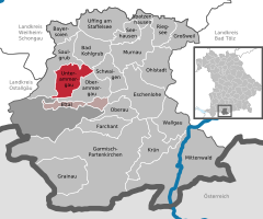
Location of Unterammergau within Garmisch-Partenkirchen district
(2020–26) Robert Stumpfecker[1]
(2022-12-31)[2]
82497
Unterammergau is a municipality in the district of Garmisch-Partenkirchen, in Bavaria, Germany. It is the site of the 11th-century Chapel of St Leonhard, patron saint of horses, which is the terminus of the annual Leonhardritt and Blessing of the Animals.
Transport
The municipality has a railway station, Unterammergau, on the Ammergau Railway.
See also
- Oberammergau
- Blessing of animals
References
- ^ Liste der ersten Bürgermeister/Oberbürgermeister in kreisangehörigen Gemeinden, Bayerisches Landesamt für Statistik, 15 July 2021.
- ^ Genesis Online-Datenbank des Bayerischen Landesamtes für Statistik Tabelle 12411-003r Fortschreibung des Bevölkerungsstandes: Gemeinden, Stichtag (Einwohnerzahlen auf Grundlage des Zensus 2011) (Hilfe dazu).
External links
- Official site
- Tourism site
- v
- t
- e
Towns and municipalities in Garmisch-Partenkirchen (district)
- Bad Bayersoien
- Bad Kohlgrub
- Eschenlohe
- Ettal
- Farchant
- Garmisch-Partenkirchen
- Grainau
- Großweil
- Krün
- Mittenwald
- Murnau am Staffelsee
- Oberammergau
- Oberau
- Ohlstadt
- Riegsee
- Saulgrub
- Schwaigen
- Seehausen am Staffelsee
- Spatzenhausen
- Uffing
- Unterammergau
- Wallgau

Authority control databases | |
|---|---|
| International |
|
| National |
|
 | This Garmisch-Partenkirchen district location article is a stub. You can help Wikipedia by expanding it. |
- v
- t
- e


