Shirakamut
40°51′38″N 44°09′10″E / 40.86056°N 44.15278°E / 40.86056; 44.15278
Place in Lori, Armenia
Shirakamut Շիրակամուտ | |
|---|---|
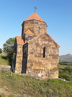 Church in the village | |
 Coat of arms | |
  Shirakamut | |
| Coordinates: 40°51′38″N 44°09′10″E / 40.86056°N 44.15278°E / 40.86056; 44.15278 | |
| Country |  Armenia Armenia |
| Province | Lori |
| Elevation | 1,650 m (5,410 ft) |
| Population (2011)[1] | |
| • Total | 2,310 |
| Time zone | UTC+4 (AMT) |
Shirakamut or previously Nalband (Armenian: Շիրակամուտ) is a village in the Lori Province of Armenia. The town was the epicenter of 1988 Armenian earthquake.
Toponymy
After the Ruso-Turkish war in 1830 several families, such as Yeranosyan, Yeghiayaryan, Naslyan, etc. left their native land Basen in Ayrarat province of the Great Hayq[2] and moved to the current area of Shirakamut or Nalband at the bank of Chichkhan river. The village is also known as Shirakarnut and previously as Nalband.
References
- ^ Statistical Committee of Armenia. "The results of the 2011 Population Census of Armenia" (PDF).
- ^ "Armenian nobility", Wikipedia, 2023-08-08, retrieved 2023-08-13
External links
Wikimedia Commons has media related to Cultural heritage monuments in Shirakamut, Lori.
- Shirakamut at GEOnet Names Server
- World Gazeteer: Armenia[dead link] – World-Gazetteer.com
- Report of the results of the 2001 Armenian Census, Statistical Committee of Armenia
- v
- t
- e
Lori ProvinceCapital: Vanadzor

- Akhtala (village)
- Aroghjaranin kits
- Bendik
- Chochkan
- Mets Ayrum
- Neghots
- Pokr Ayrum
Portal:
 Geography

 | This article about a location in Lori Province, Armenia is a stub. You can help Wikipedia by expanding it. |
- v
- t
- e


