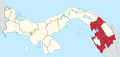
Santa Fe, Darién
Corregimiento and town in Darién, Panama
8°39′23″N 78°8′54″W / 8.65639°N 78.14833°W / 8.65639; -78.14833 Panama
 (2010)[1]
Santa Fé is a corregimiento and town in Chepigana District, Darién Province, Panama with a population of 6,923 as of 2010.[1] It was created by Law 58 of July 29, 1998, owing to the Declaration of Unconstitutionality of Law 1 of 1982.[1] Its population as of 2000 was 5,764.[1] It is approximately 200 km east of Panama City on the Inter-American Highway.[2] The town contains a hospital. It is served by bus.[2]
References
- ^ a b c d e f "Cuadro 11 (Superficie, población y densidad de población en la República...)" [Table 11 (Area, population, and population density in the Republic...)] (.xls). In "Resultados Finales Básicos" [Basic Final Results] (in Spanish). National Institute of Statistics and Census of Panama. Retrieved May 26, 2015.
- ^ a b Friar, William. Panama. Moon Publications (2008), p. 422. ISBN 1-59880-085-X.
- v
- t
- e
- Agua Fría
- Cucunatí
- Río Congo
- Río Congo Arriba
- Río Iglesias
- Santa Fe
- Zapallal
This article about the geography of Darién Province is a stub. You can help Wikipedia by expanding it. |
- v
- t
- e


