Nullawil
Town in Victoria, Australia
35°51′0″S 143°11′0″E / 35.85000°S 143.18333°E / -35.85000; 143.18333- 302 km (188 mi) NW of Melbourne
- 162 km (101 mi) NW of Bendigo
- 80 km (50 mi) SW of Swan Hill
- 56 km (35 mi) NW of Charlton
- 26 km (16 mi) NW of Wycheproof
| Localities around Nullawil: | ||
| Warne | Warne | Kalpienung |
| Jil Jil | Nullawil | Kalpienung |
| Whirily | Dumosa | Dumosa |
Nullawil is a locality in Victoria, Australia, located approximately 302 kilometres (188 mi) from the state capital, Melbourne. At the 2021 census, Nullawil had a population of 92.[1]
It is thought that the name of the settlement derives from two Aboriginal words: "nulla", meaning killing stick, and "wil", from "willock", meaning galah.[2]
The railway came to Nullawil in March 1895, when the line was extended from Wycheproof to Sea Lake.[3] Passenger services ceased in May 1977. The post office opened on 26 April 1897.[4]
Gallery
-
 General store, 2012
 -
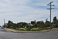 Town park, 2012
 -
 St Joseph's Catholic Church, 2012


References
Wikimedia Commons has media related to Nullawil.
- ^ a b Australian Bureau of Statistics (28 June 2022). "Nullawil (Suburbs and Localities)". 2021 Census QuickStats. Retrieved 13 November 2022.

- ^ "Nullawil, Smug". Silo Art Trail. Retrieved 19 October 2023.
- ^ "Nullawil". Vicsig. Retrieved 19 October 2023.
- ^ Phoenix Auctions History. "Post Office List". Retrieved 29 March 2021.
- v
- t
- e
Localities in the Shire of Buloke

- Ballapur
- Banyan
- Barrakee
- Berriwillock
- Bimbourie
- Birchip West
- Boigbeat
- Buckrabanyule^
- Bunguluke
- Carron
- Chirrip
- Cokum
- Coonooer Bridge^
- Cope Cope^
- Corack
- Corack East
- Culgoa
- Curyo
- Dooboobetic
- Dumosa
- Gil Gil
- Glenloth
- Glenloth East^
- Granite Flat
- Jeffcott
- Jeffcott North
- Jeruk
- Jil Jil
- Kalpienung
- Karyrie
- Kinnabulla
- Laen^
- Laen East
- Laen North
- Lake Marmal^
- Lake Tyrrell
- Lawler^
- Litchfield
- Marlbed
- Massey
- Morton Plains
- Myall
- Nandaly
- Nareewillock
- Narraport
- Ninda
- Nine Mile^
- Nullawil
- Nyarrin
- Pier Milan
- Reedy Dam
- Rich Avon
- Richmond Plains^
- Springfield
- Straten
- Sutton
- Teddywaddy
- Teddywaddy West
- Terrappee^
- Thalia
- Tittybong^
- Towaninny^
- Towaninny South
- Turriff East
- Tyenna
- Tyrrell^
- Tyrrell Downs
- Wangie
- Warmur
- Warne
- Watchem
- Watchem West^
- Watchupga
- Whirily
- Wilkur^
- Willangie
- Wooroonook
- Woosang^
- Wycheproof South
- Yawong Hills
- Yeungroon
- Yeungroon East^
^ - Territory divided with another LGA
 | This article about a location in Victoria, Australia is a stub. You can help Wikipedia by expanding it. |
- v
- t
- e


