Meranti Islands Regency
Regency in Riau, Indonesia
Meranti Islands Regency Kabupaten Kepulauan Meranti | |
|---|---|
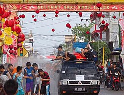 Lunar New Year festival in Selat Panjang | |
 Coat of arms | |
 | |
| Country | Indonesia |
| Province | Riau |
| Regency seat | Selat Panjang |
| Government | |
| • Regent | Muhammad Adil |
| Area | |
| • Total | 3,623.93 km2 (1,399.21 sq mi) |
| Population (mid 2023 estimate)[1] | |
| • Total | 211,771 |
| • Density | 58/km2 (150/sq mi) |
| Time zone | UTC+7 (WIB) |
| Website | www.merantikab.go.id |
Meranti Islands (Kepulauan Meranti) is an archipelago, most of which forms a regency (kabupaten) of Riau Province and lies off the eastern coast of the island of Sumatra, Indonesia. It was created on 19 December 2008 by the separating of these large islands from the mainly mainland regency of Bengkalis. The regency comprises the islands of Tebing Tinggi, Rangsang, Padang, and Merbau, together with minor offshore islands, but does not include Bengkalis Island to the north, which is geographically part of the archipelago but remains within Bengkalis Regency. The principal town is Selat Panjang (also written as Selatpanjang) on Tebing Tinggi Island. The regency covers an area of 3,623.93 km2 and had a population of 176,290 at the 2010 Census[2] and 206,116 at the 2020 Census;[3] the official estimate as of mid-2023 was 211,771 (comprising 109,080 males and 102,690 females).[1]
Administrative districts
When created in 2008, the regency was divided into five districts (kecamatan), listed below with their populations at the 2010 Census:[2]
| Name of District (kecamatan) | English name | Pop'n Census 2010 |
|---|---|---|
| Tebing Tinggi Barat | Western Tebing Tinggi Island | 15,260 |
| Tebing Tinggi | (Eastern) Tebing Tinggi Island | 65,748 |
| Rangsang | (Eastern) Rangsang Island | 26,526 |
| Rangsang Barat | Western Rangsang Island | 24,926 |
| Merbau | Merbau and Padang Islands | 44,030 |
On 26 January 2011, the regency was re-divided into nine districts. The additional four districts are Tebing Tinggi Timur (East Tebing Tinggi Island, leaving the residual area of Tebing Tinggi District to cover the town of Selat Panjang), Rangsang Pesisir (Coastal Rangsang), Pulau Merbau (Merbau Island, leaving the residual area of Merbau District to cover the southern part of Padang Island) and Tasik Putri Puyu (covering the northern part of Padang Island). The areas and the populations of the nine districts at the 2020 Census,[3] together with the official estimates as of mid-2023,[1] are as follows. The table also includes the locations of the district administrative centres, the number of administrative villages in each district (totaling 96 rural desa and 5 urban kelurahan), and its postcode.
| Kode Wilayah | Name of District (kecamatan) | Area in km2 | Pop'n 2020 Census | Pop'n mid 2023 Estimate | Admin centre | No. of villages | Post code |
|---|---|---|---|---|---|---|---|
| 14.10.04 | Tebing Tinggi Barat | 489.46 | 18,382 | 19,500 | Alai | 14 | 28758 |
| 14.10.01 | Tebing Tinggi (town) | 89.38 | 67,219 | 66,400 | Selat Panjang | 9 (a) | 28753 |
| 14.10.07 | Tebing Tinggi Timur | 800.47 | 13,293 | 14,200 | Sungai Tohor | 10 | 28754 |
| 14.10.03 | Rangsang | 420.73 | 20,123 | 20,800 | Tanjung Samak | 14 | 28755 |
| 14.10.09 | Rangsang Pesisir (Coastal Rangsang) | 371.35 | 18,853 | 19,800 | Telesung | 11 | 28757 |
| 14.10.02 | Rangsang Barat | 116.38 | 19,488 | 20,300 | Bantar | 12 | 28756 |
| 14.10.05 | Merbau | 553.82 | 15,305 | 15,900 | Teluk Belitung | 10 (b) | 28752 |
| 14.10.06 | Pulau Merbau | 216.14 | 15,824 | 16,900 | Semukut | 11 | 28750 |
| 14.10.08 | Tasik Putri Puyu | 556.22 | 17,629 | 18,100 | Bandul | 10 | 28751 |
| Totals | 3,623.93 | 206,116 | 211,771 | Selatpanjang | 101 |
Notes: (a) comprising 4 kelurahan (Selat Panjang Barat, Selat Panjang Kota, Selat Panjang Selatan and Selat Panjang Timur) and 5 desa.
(b) including one kelurahan - Teluk Belitung.
1°0′N 102°42′E / 1.000°N 102.700°E / 1.000; 102.700
References
- ^ a b c Badan Pusat Statistik, Jakarta, 28 February 2024, Kabupaten Kepulauan Meranti Dalam Angka 2024 (Katalog-BPS 1102001.1410)
- ^ a b Biro Pusat Statistik, Jakarta, 2011.
- ^ a b Badan Pusat Statistik, Jakarta, 2021.
- v
- t
- e
Capital: Pekanbaru
- Bengkalis
- Indragiri Hilir
- Indragiri Hulu
- Kampar
- Meranti Islands
- Kuantan Singingi
- Pelalawan
- Rokan Hulu
- Rokan Hilir
- Siak

Authority control databases | |
|---|---|
| International |
|
| National |
|


