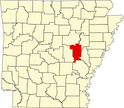
List of lakes of Prairie County, Arkansas
Map all coordinates using OpenStreetMap
Download coordinates as:
- KML
- GPX (all coordinates)
- GPX (primary coordinates)
- GPX (secondary coordinates)
There are at least 83 named lakes and reservoirs in Prairie County, Arkansas.
Lakes
- Alligator Lake, 34°55′36″N 091°27′31″W / 34.92667°N 91.45861°W / 34.92667; -91.45861 (Alligator Lake), el. 167 feet (51 m) [1]
- Bean Lake, 34°59′39″N 091°29′56″W / 34.99417°N 91.49889°W / 34.99417; -91.49889 (Bean Lake), el. 174 feet (53 m) [2]
- Belcher Lake, 34°36′22″N 091°39′02″W / 34.60611°N 91.65056°W / 34.60611; -91.65056 (Belcher Lake), el. 194 feet (59 m) [3]
- Big Brushy Lake, 34°45′49″N 091°24′06″W / 34.76361°N 91.40167°W / 34.76361; -91.40167 (Big Brushy Lake), el. 164 feet (50 m) [4]
- Big Twin Lake, 34°44′26″N 091°23′02″W / 34.74056°N 91.38389°W / 34.74056; -91.38389 (Big Twin Lake), el. 161 feet (49 m) [5]
- Big Twin Lake, 34°56′03″N 091°22′49″W / 34.93417°N 91.38028°W / 34.93417; -91.38028 (Big Twin Lake), el. 171 feet (52 m) [6]
- Prairie County, 34°51′29″N 091°27′26″W / 34.85806°N 91.45722°W / 34.85806; -91.45722 (Black Lake), el. 171 feet (52 m) [7]
- Blind Basin, 35°01′02″N 091°33′17″W / 35.01722°N 91.55472°W / 35.01722; -91.55472 (Blind Basin), el. 174 feet (53 m) [8]
- Blue Hole, 34°53′59″N 091°25′45″W / 34.89972°N 91.42917°W / 34.89972; -91.42917 (Blue Hole), el. 167 feet (51 m) [9]
- Blue Lake, 34°48′23″N 091°27′14″W / 34.80639°N 91.45389°W / 34.80639; -91.45389 (Blue Lake), el. 171 feet (52 m) [10]
- Blue Lake, 35°02′12″N 091°23′03″W / 35.03667°N 91.38417°W / 35.03667; -91.38417 (Blue Lake), el. 174 feet (53 m) [11]
- Bob Williams Lake, 34°55′49″N 091°24′35″W / 34.93028°N 91.40972°W / 34.93028; -91.40972 (Bob Williams Lake), el. 174 feet (53 m) [12]
- Cagles Eddy, 34°55′01″N 091°28′20″W / 34.91694°N 91.47222°W / 34.91694; -91.47222 (Cagles Eddy), el. 164 feet (50 m) [13]
- Choctaw Lake, 35°00′31″N 091°27′12″W / 35.00861°N 91.45333°W / 35.00861; -91.45333 (Choctaw Lake), el. 174 feet (53 m) [14]
- Clear Lake, 35°01′56″N 091°24′23″W / 35.03222°N 91.40639°W / 35.03222; -91.40639 (Clear Lake), el. 180 feet (55 m) [15]
- Coitier Basin, 35°00′55″N 091°33′14″W / 35.01528°N 91.55389°W / 35.01528; -91.55389 (Coitier Basin), el. 174 feet (53 m) [16]
- Cooper Lake, 34°38′23″N 091°38′46″W / 34.63972°N 91.64611°W / 34.63972; -91.64611 (Cooper Lake), el. 197 feet (60 m) [17]
- Goose Basin, 35°00′16″N 091°31′58″W / 35.00444°N 91.53278°W / 35.00444; -91.53278 (Goose Basin), el. 174 feet (53 m) [18]
- Goose Pond, 35°02′23″N 091°28′07″W / 35.03972°N 91.46861°W / 35.03972; -91.46861 (Goose Pond), el. 180 feet (55 m) [19]
- Graveyard Slough, 34°54′42″N 091°23′28″W / 34.91167°N 91.39111°W / 34.91167; -91.39111 (Graveyard Slough), el. 171 feet (52 m) [20]
- Hall's Lake, 34°54′45″N 091°22′24″W / 34.91250°N 91.37333°W / 34.91250; -91.37333 (Halls Lake), el. 164 feet (50 m) [21]
- Harvey Lake, 34°59′25″N 091°29′24″W / 34.99028°N 91.49000°W / 34.99028; -91.49000 (Harvey Lake), el. 174 feet (53 m) [22]
- Hendricks Lake, 34°47′06″N 091°24′46″W / 34.78500°N 91.41278°W / 34.78500; -91.41278 (Hendricks Lake), el. 171 feet (52 m) [23]
- Hicks Lake, 35°01′27″N 091°28′41″W / 35.02417°N 91.47806°W / 35.02417; -91.47806 (Hicks Lake), el. 174 feet (53 m) [24]
- Hill Lake, 35°02′47″N 091°28′28″W / 35.04639°N 91.47444°W / 35.04639; -91.47444 (Hill Lake), el. 180 feet (55 m) [25]
- Hodges Lake, 34°50′51″N 091°26′22″W / 34.84750°N 91.43944°W / 34.84750; -91.43944 (Hodges Lake), el. 171 feet (52 m) [26]
- Horn Lake, 34°56′49″N 091°26′26″W / 34.94694°N 91.44056°W / 34.94694; -91.44056 (Horn Lake), el. 174 feet (53 m) [27]
- Horseshoe Lake, 34°48′28″N 091°26′37″W / 34.80778°N 91.44361°W / 34.80778; -91.44361 (Horseshoe Lake), el. 171 feet (52 m) [28]
- Horseshoe Lake, 34°55′08″N 091°27′05″W / 34.91889°N 91.45139°W / 34.91889; -91.45139 (Horseshoe Lake), el. 174 feet (53 m) [29]
- Horseshoe Lake, 35°01′09″N 091°29′23″W / 35.01917°N 91.48972°W / 35.01917; -91.48972 (Horseshoe Lake), el. 167 feet (51 m) [30]
- Jake Williams Lake, 34°54′45″N 091°24′16″W / 34.91250°N 91.40444°W / 34.91250; -91.40444 (Jake Williams Lake), el. 171 feet (52 m) [31]
- Keathley Pond, 35°05′08″N 091°32′12″W / 35.08556°N 91.53667°W / 35.08556; -91.53667 (Keathley Pond), el. 197 feet (60 m) [32]
- Lindermans Lake, 35°01′57″N 091°38′32″W / 35.03250°N 91.64222°W / 35.03250; -91.64222 (Lindermans Lake), el. 184 feet (56 m) [33]
- Little Brushy Lake, 34°46′02″N 091°24′25″W / 34.76722°N 91.40694°W / 34.76722; -91.40694 (Little Brushy Lake), el. 167 feet (51 m) [34]
- Little Gum Pond, 35°04′04″N 091°31′33″W / 35.06778°N 91.52583°W / 35.06778; -91.52583 (Little Gum Pond), el. 180 feet (55 m) [35]
- Little Lake, 35°03′08″N 091°39′25″W / 35.05222°N 91.65694°W / 35.05222; -91.65694 (Little Lake), el. 184 feet (56 m) [36]
- Little Twin Lake, 34°55′50″N 091°22′55″W / 34.93056°N 91.38194°W / 34.93056; -91.38194 (Little Twin Lake), el. 171 feet (52 m) [37]
- Loggy Bayou, 35°02′36″N 091°27′28″W / 35.04333°N 91.45778°W / 35.04333; -91.45778 (Loggy Bayou), el. 174 feet (53 m) [38]
- Maloy Lake, 34°49′23″N 091°22′29″W / 34.82306°N 91.37472°W / 34.82306; -91.37472 (Maloy Lake), el. 161 feet (49 m) [39]
- Miller Lake, 34°45′45″N 091°23′41″W / 34.76250°N 91.39472°W / 34.76250; -91.39472 (Miller Lake), el. 164 feet (50 m) [40]
- Moore's Lake, 34°50′37″N 091°28′09″W / 34.84361°N 91.46917°W / 34.84361; -91.46917 (Moores Lake), el. 171 feet (52 m) [41]
- Old River Lake, 34°47′01″N 091°24′11″W / 34.78361°N 91.40306°W / 34.78361; -91.40306 (Old River Lake), el. 164 feet (50 m) [42]
- Old River Lake, 34°59′50″N 091°30′05″W / 34.99722°N 91.50139°W / 34.99722; -91.50139 (Old River Lake), el. 174 feet (53 m) [43]
- Peppers Lake, 34°44′49″N 091°24′57″W / 34.74694°N 91.41583°W / 34.74694; -91.41583 (Peppers Lake), el. 161 feet (49 m) [44]
- Roc Roe Lake, 34°43′57″N 091°22′47″W / 34.73250°N 91.37972°W / 34.73250; -91.37972 (Roc Roe Lake), el. 161 feet (49 m) [45]
- Round Basin, 35°00′34″N 091°31′57″W / 35.00944°N 91.53250°W / 35.00944; -91.53250 (Round Basin), el. 174 feet (53 m) [46]
- Round Lake, 34°56′37″N 091°28′31″W / 34.94361°N 91.47528°W / 34.94361; -91.47528 (Round Lake), el. 171 feet (52 m) [47]
- Slaughters Lake, 34°42′53″N 091°23′00″W / 34.71472°N 91.38333°W / 34.71472; -91.38333 (Slaughters Lake), el. 154 feet (47 m) [48]
- Slippery Lake, 34°51′45″N 091°26′32″W / 34.86250°N 91.44222°W / 34.86250; -91.44222 (Slippery Lake), el. 177 feet (54 m) [49]
- Spring Lake, 34°57′10″N 091°27′30″W / 34.95278°N 91.45833°W / 34.95278; -91.45833 (Spring Lake), el. 171 feet (52 m) [50]
- Straight Lake, 34°56′45″N 091°27′07″W / 34.94583°N 91.45194°W / 34.94583; -91.45194 (Straight Lake), el. 174 feet (53 m) [51]
- The Basin, 34°47′03″N 091°27′18″W / 34.78417°N 91.45500°W / 34.78417; -91.45500 (The Basin), el. 157 feet (48 m) [52]
- Twin Lakes, 34°59′22″N 091°28′37″W / 34.98944°N 91.47694°W / 34.98944; -91.47694 (Twin Lakes), el. 180 feet (55 m) [53]
- Twin Lakes, 34°48′04″N 091°27′03″W / 34.80111°N 91.45083°W / 34.80111; -91.45083 (Twin Lakes), el. 171 feet (52 m) [54]
- Tyler Lake, 34°39′45″N 091°40′29″W / 34.66250°N 91.67472°W / 34.66250; -91.67472 (Tyler Lake), el. 194 feet (59 m) [55]
- Upshaw Lake, 34°47′21″N 091°25′58″W / 34.78917°N 91.43278°W / 34.78917; -91.43278 (Upshaw Lake), el. 164 feet (50 m) [56]
- Webb Lake, 34°49′52″N 091°27′55″W / 34.83111°N 91.46528°W / 34.83111; -91.46528 (Webb Lake), el. 171 feet (52 m) [57]
Reservoirs
- Aker Reservoir, 34°34′57″N 091°29′51″W / 34.58250°N 91.49750°W / 34.58250; -91.49750 (Aker Reservoir), el. 207 feet (63 m) [58]
- Argo Reservoir, 34°47′29″N 091°28′59″W / 34.79139°N 91.48306°W / 34.79139; -91.48306 (Argo Reservoir), el. 217 feet (66 m) [59]
- Catfish Lake, 34°45′34″N 091°27′51″W / 34.75944°N 91.46417°W / 34.75944; -91.46417 (Catfish Lake), el. 220 feet (67 m) [60]
- Crowley Lake, 34°52′01″N 091°34′24″W / 34.86694°N 91.57333°W / 34.86694; -91.57333 (Crowley Lake), el. 213 feet (65 m) [61]
- Eddy Lake, 34°55′14″N 091°28′42″W / 34.92056°N 91.47833°W / 34.92056; -91.47833 (Eddy Lake), el. 194 feet (59 m) [62]
- Floyds Reservoir, 34°50′19″N 091°35′56″W / 34.83861°N 91.59889°W / 34.83861; -91.59889 (Floyds Reservoir), el. 220 feet (67 m) [63]
- Frakers Reservoir, 34°45′24″N 091°29′31″W / 34.75667°N 91.49194°W / 34.75667; -91.49194 (Frakers Reservoir), el. 210 feet (64 m) [64]
- Hansons Reservoir, 34°46′48″N 091°39′10″W / 34.78000°N 91.65278°W / 34.78000; -91.65278 (Hansons Reservoir), el. 233 feet (71 m) [65]
- Hartz Reservoir, 34°41′57″N 091°32′54″W / 34.69917°N 91.54833°W / 34.69917; -91.54833 (Hartz Reservoir), el. 207 feet (63 m) [66]
- Holloway Pond, 35°04′02″N 091°32′02″W / 35.06722°N 91.53389°W / 35.06722; -91.53389 (Holloway Pond), el. 200 feet (61 m) [67]
- Jerome Lake, 34°51′38″N 091°34′36″W / 34.86056°N 91.57667°W / 34.86056; -91.57667 (Jerome Lake), el. 213 feet (65 m) [68]
- Joe Uhiren Reservoir, 34°41′18″N 091°41′16″W / 34.68833°N 91.68778°W / 34.68833; -91.68778 (Joe Uhiren Reservoir), el. 217 feet (66 m) [69]
- Lake Des Arc, 35°01′29″N 091°30′53″W / 35.02472°N 91.51472°W / 35.02472; -91.51472 (Lake Des Arc), el. 187 feet (57 m) [70]
- Lake Treadway, 34°50′33″N 091°39′45″W / 34.84250°N 91.66250°W / 34.84250; -91.66250 (Lake Treadway), el. 230 feet (70 m) [71]
- Lost Island Reservoir, 34°34′12″N 091°30′42″W / 34.57000°N 91.51167°W / 34.57000; -91.51167 (Lost Island Reservoir), el. 203 feet (62 m) [72]
- Menett Reservoir, 34°36′06″N 091°29′32″W / 34.60167°N 91.49222°W / 34.60167; -91.49222 (Menett Reservoir), el. 197 feet (60 m) [73]
- Miers Lake, 34°46′03″N 091°28′14″W / 34.76750°N 91.47056°W / 34.76750; -91.47056 (Miers Lake), el. 213 feet (65 m) [74]
- Newkirks Reservoir Number 1, 34°40′45″N 091°24′16″W / 34.67917°N 91.40444°W / 34.67917; -91.40444 (Newkirks Reservoir Number 1), el. 207 feet (63 m) [75]
- Newkirks Reservoir Number 2, 34°40′20″N 091°22′52″W / 34.67222°N 91.38111°W / 34.67222; -91.38111 (Newkirks Reservoir Number 2), el. 171 feet (52 m) [76]
- Omni Pond, 34°57′12″N 091°38′41″W / 34.95333°N 91.64472°W / 34.95333; -91.64472 (Omni Pond), el. 213 feet (65 m) [77]
- Stroh Reservoir, 34°41′49″N 091°29′28″W / 34.69694°N 91.49111°W / 34.69694; -91.49111 (Stroh Reservoir), el. 217 feet (66 m) [78]
- Tates Reservoir, 34°59′27″N 091°33′15″W / 34.99083°N 91.55417°W / 34.99083; -91.55417 (Tates Reservoir), el. 200 feet (61 m) [79]
- Thomas Reservoir Number 2, 34°41′58″N 091°37′09″W / 34.69944°N 91.61917°W / 34.69944; -91.61917 (Thomas Reservoir Number 2), el. 220 feet (67 m) [80]
- Whiskey Creek Reservoir, 34°43′40″N 091°25′01″W / 34.72778°N 91.41694°W / 34.72778; -91.41694 (Whiskey Creek Reservoir), el. 197 feet (60 m) [81]
- Wing Meade Reservoir, 34°41′49″N 091°29′28″W / 34.69694°N 91.49111°W / 34.69694; -91.49111 (Wing Meade Reservoir), el. 217 feet (66 m) [82]
- Wolf Reservoir, 34°35′06″N 091°31′42″W / 34.58500°N 91.52833°W / 34.58500; -91.52833 (Wolf Reservoir), el. 213 feet (65 m) [83]
See also
Notes
- ^ "Alligator Lake". Geographic Names Information System. United States Geological Survey, United States Department of the Interior.
- ^ "Bean Lake". Geographic Names Information System. United States Geological Survey, United States Department of the Interior.
- ^ "Belcher Lake". Geographic Names Information System. United States Geological Survey, United States Department of the Interior.
- ^ "Big Brushy Lake". Geographic Names Information System. United States Geological Survey, United States Department of the Interior.
- ^ "Big Twin Lake". Geographic Names Information System. United States Geological Survey, United States Department of the Interior.
- ^ "Big Twin Lake". Geographic Names Information System. United States Geological Survey, United States Department of the Interior.
- ^ "Black Lake". Geographic Names Information System. United States Geological Survey, United States Department of the Interior.
- ^ "Blind Basin". Geographic Names Information System. United States Geological Survey, United States Department of the Interior.
- ^ "Blue Hole". Geographic Names Information System. United States Geological Survey, United States Department of the Interior.
- ^ "Blue Lake". Geographic Names Information System. United States Geological Survey, United States Department of the Interior.
- ^ "Blue Lake". Geographic Names Information System. United States Geological Survey, United States Department of the Interior.
- ^ "Bob Williams Lake". Geographic Names Information System. United States Geological Survey, United States Department of the Interior.
- ^ "Cagles Eddy". Geographic Names Information System. United States Geological Survey, United States Department of the Interior.
- ^ "Choctaw Lake". Geographic Names Information System. United States Geological Survey, United States Department of the Interior.
- ^ "Clear Lake". Geographic Names Information System. United States Geological Survey, United States Department of the Interior.
- ^ "Coitier Basin". Geographic Names Information System. United States Geological Survey, United States Department of the Interior.
- ^ "Cooper Lake". Geographic Names Information System. United States Geological Survey, United States Department of the Interior.
- ^ "Goose Basin". Geographic Names Information System. United States Geological Survey, United States Department of the Interior.
- ^ "Goose Pond". Geographic Names Information System. United States Geological Survey, United States Department of the Interior.
- ^ "Graveyard Slough". Geographic Names Information System. United States Geological Survey, United States Department of the Interior.
- ^ "Halls Lake". Geographic Names Information System. United States Geological Survey, United States Department of the Interior.
- ^ "Harvey Lake". Geographic Names Information System. United States Geological Survey, United States Department of the Interior.
- ^ "Hendricks Lake". Geographic Names Information System. United States Geological Survey, United States Department of the Interior.
- ^ "Hicks Lake". Geographic Names Information System. United States Geological Survey, United States Department of the Interior.
- ^ "Hill Lake". Geographic Names Information System. United States Geological Survey, United States Department of the Interior.
- ^ "Hodges Lake". Geographic Names Information System. United States Geological Survey, United States Department of the Interior.
- ^ "Horn Lake". Geographic Names Information System. United States Geological Survey, United States Department of the Interior.
- ^ "Horseshoe Lake". Geographic Names Information System. United States Geological Survey, United States Department of the Interior.
- ^ "Horseshoe Lake". Geographic Names Information System. United States Geological Survey, United States Department of the Interior.
- ^ "Horseshoe Lake". Geographic Names Information System. United States Geological Survey, United States Department of the Interior.
- ^ "Jake Williams Lake". Geographic Names Information System. United States Geological Survey, United States Department of the Interior.
- ^ "Keathley Pond". Geographic Names Information System. United States Geological Survey, United States Department of the Interior.
- ^ "Lindermans Lake". Geographic Names Information System. United States Geological Survey, United States Department of the Interior.
- ^ "Little Brushy Lake". Geographic Names Information System. United States Geological Survey, United States Department of the Interior.
- ^ "Little Gum Pond". Geographic Names Information System. United States Geological Survey, United States Department of the Interior.
- ^ "Little Lake". Geographic Names Information System. United States Geological Survey, United States Department of the Interior.
- ^ "Little Twin Lake". Geographic Names Information System. United States Geological Survey, United States Department of the Interior.
- ^ "Loggy Bayou". Geographic Names Information System. United States Geological Survey, United States Department of the Interior.
- ^ "Maloy Lake". Geographic Names Information System. United States Geological Survey, United States Department of the Interior.
- ^ "Miller Lake". Geographic Names Information System. United States Geological Survey, United States Department of the Interior.
- ^ "Moores Lake". Geographic Names Information System. United States Geological Survey, United States Department of the Interior.
- ^ "Old River Lake". Geographic Names Information System. United States Geological Survey, United States Department of the Interior.
- ^ "Old River Lake". Geographic Names Information System. United States Geological Survey, United States Department of the Interior.
- ^ "Peppers Lake". Geographic Names Information System. United States Geological Survey, United States Department of the Interior.
- ^ "Roc Roe Lake". Geographic Names Information System. United States Geological Survey, United States Department of the Interior.
- ^ "Round Basin". Geographic Names Information System. United States Geological Survey, United States Department of the Interior.
- ^ "Round Lake". Geographic Names Information System. United States Geological Survey, United States Department of the Interior.
- ^ "Slaughters Lake". Geographic Names Information System. United States Geological Survey, United States Department of the Interior.
- ^ "Slippery Lake". Geographic Names Information System. United States Geological Survey, United States Department of the Interior.
- ^ "Spring Lake". Geographic Names Information System. United States Geological Survey, United States Department of the Interior.
- ^ "Straight Lake". Geographic Names Information System. United States Geological Survey, United States Department of the Interior.
- ^ "The Basin". Geographic Names Information System. United States Geological Survey, United States Department of the Interior.
- ^ "Twin Lakes". Geographic Names Information System. United States Geological Survey, United States Department of the Interior.
- ^ "Twin Lakes". Geographic Names Information System. United States Geological Survey, United States Department of the Interior.
- ^ "Tyler Lake". Geographic Names Information System. United States Geological Survey, United States Department of the Interior.
- ^ "Upshaw Lake". Geographic Names Information System. United States Geological Survey, United States Department of the Interior.
- ^ "Webb Lake". Geographic Names Information System. United States Geological Survey, United States Department of the Interior.
- ^ "Aker Reservoir". Geographic Names Information System. United States Geological Survey, United States Department of the Interior.
- ^ "Argo Reservoir". Geographic Names Information System. United States Geological Survey, United States Department of the Interior.
- ^ "Catfish Lake". Geographic Names Information System. United States Geological Survey, United States Department of the Interior.
- ^ "Crowley Lake". Geographic Names Information System. United States Geological Survey, United States Department of the Interior.
- ^ "Eddy Lake". Geographic Names Information System. United States Geological Survey, United States Department of the Interior.
- ^ "Floyds Reservoir". Geographic Names Information System. United States Geological Survey, United States Department of the Interior.
- ^ "Frakers Reservoir". Geographic Names Information System. United States Geological Survey, United States Department of the Interior.
- ^ "Hansons Reservoir". Geographic Names Information System. United States Geological Survey, United States Department of the Interior.
- ^ "Hartz Reservoir". Geographic Names Information System. United States Geological Survey, United States Department of the Interior.
- ^ "Holloway Pond". Geographic Names Information System. United States Geological Survey, United States Department of the Interior.
- ^ "Jerome Lake". Geographic Names Information System. United States Geological Survey, United States Department of the Interior.
- ^ "Joe Uhiren Reservoir". Geographic Names Information System. United States Geological Survey, United States Department of the Interior.
- ^ "Lake Des Arc". Geographic Names Information System. United States Geological Survey, United States Department of the Interior.
- ^ "Lake Treadway". Geographic Names Information System. United States Geological Survey, United States Department of the Interior.
- ^ "Lost Island Reservoir". Geographic Names Information System. United States Geological Survey, United States Department of the Interior.
- ^ "Menett Reservoir". Geographic Names Information System. United States Geological Survey, United States Department of the Interior.
- ^ "Miers Lake". Geographic Names Information System. United States Geological Survey, United States Department of the Interior.
- ^ "Newkirks Reservoir Number 1". Geographic Names Information System. United States Geological Survey, United States Department of the Interior.
- ^ "Newkirks Reservoir Number 2". Geographic Names Information System. United States Geological Survey, United States Department of the Interior.
- ^ "Omni Pond". Geographic Names Information System. United States Geological Survey, United States Department of the Interior.
- ^ "Stroh Reservoir". Geographic Names Information System. United States Geological Survey, United States Department of the Interior.
- ^ "Tates Reservoir". Geographic Names Information System. United States Geological Survey, United States Department of the Interior.
- ^ "Thomas Reservoir Number 2". Geographic Names Information System. United States Geological Survey, United States Department of the Interior.
- ^ "Whiskey Creek Reservoir". Geographic Names Information System. United States Geological Survey, United States Department of the Interior.
- ^ "Wing Meade Reservoir". Geographic Names Information System. United States Geological Survey, United States Department of the Interior.
- ^ "Wolf Reservoir". Geographic Names Information System. United States Geological Survey, United States Department of the Interior.
- v
- t
- e
Municipalities and communities of Prairie County, Arkansas, United States
County seats: Des Arc and DeValls Bluff
- Fredonia (Biscoe)
- Ulm
communities
‡This populated place also has portions in an adjacent county of counties
- Arkansas portal
- United States portal


