Hruboňovo
Municipality of Slovakia
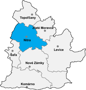
Hruboňovo (Hungarian: Szulányvicsáp) is a village and municipality in the Nitra District in western central Slovakia, in the Nitra Region.[1]
History
In historical records the village was first mentioned in 1247.
Geography
The village lies at an altitude of 155 metres and covers an area of 11.551 km2. It has a population of about 485 people.
Ethnicity
According to population data for 2011, the city has a population of 508 people.[2]
The village is approximately 100% Slovak.
Facilities
The village has a public library and football pitch.
See also
References
Genealogical resources
The records for genealogical research are available at the state archive "Statny Archiv in Nitra, Slovakia"
External links
- https://web.archive.org/web/20071217080336/http://www.statistics.sk/mosmis/eng/run.html
- Surnames of living people in Hrubonovo
- v
- t
- e
Municipalities of Nitra District
- Nitra
- Vráble
- Alekšince
- Báb
- Babindol
- Bádice
- Branč
- Cabaj-Čápor
- Čab
- Čakajovce
- Čechynce
- Čeľadice
- Čifáre
- Dolné Lefantovce
- Dolné Obdokovce
- Golianovo
- Horné Lefantovce
- Hosťová
- Hruboňovo
- Ivanka pri Nitre
- Jarok
- Jelenec
- Jelšovce
- Kapince
- Klasov
- Kolíňany
- Lehota
- Lúčnica nad Žitavou
- Lukáčovce
- Lužianky
- Ľudovítová
- Malé Chyndice
- Malé Zálužie
- Malý Cetín
- Malý Lapáš
- Melek
- Mojmírovce
- Nitrianske Hrnčiarovce
- Nová Ves nad Žitavou
- Nové Sady
- Paňa
- Podhorany
- Pohranice
- Poľný Kesov
- Rišňovce
- Rumanová
- Svätoplukovo
- Štefanovičová
- Štitáre
- Šurianky
- Tajná
- Telince
- Veľká Dolina
- Veľké Chyndice
- Veľké Zálužie
- Veľký Cetín
- Veľký Lapáš
- Vinodol
- Výčapy-Opatovce
- Zbehy
- Žirany
- Žitavce

48°26′50″N 18°01′30″E / 48.44722°N 18.02500°E / 48.44722; 18.02500
| Authority control databases |
|
|---|
 | This Nitra Region geography article is a stub. You can help Wikipedia by expanding it. |
- v
- t
- e


