Hotazel
Place in Northern Cape, South Africa
27°12′S 22°57′E / 27.200°S 22.950°E / -27.200; 22.950 (2011)[1]
8490
8490
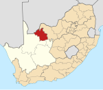
Hotazel is a town in John Taolo Gaetsewe District Municipality in the Northern Cape province of South Africa.
The town serves the manganese mines, 147 km (91 mi) north of Postmasburg and 46 km (28.6 mi) north-west of Kuruman. It takes its name from the farm on which it was laid out; a pun on 'hot as hell', referring to the weather when the farm was surveyed and the generally torrid climate surrounding the area.[2]
References
- ^ a b c d "Main Place Hotazel". Census 2011.
- ^ Raper, R.E. (1987). Dictionary of Southern African Place Names. Human Science Research Council. p. 214.
Places adjacent to Hotazel | |
|---|---|


- v
- t
- e
Municipalities and communities of John Taolo Gaetsewe District Municipality, Northern Cape
District seat: Kuruman
- Cassel
- Dithakong
- Heuningvlei
- Hotazel
- Van Zylsrus
 | This Northern Cape location article is a stub. You can help Wikipedia by expanding it. |
- v
- t
- e


