Hollersbach im Pinzgau
Place in Salzburg, Austria
Hollersbach im Pinzgau Hoierschbouch an Pinzgau | |
|---|---|
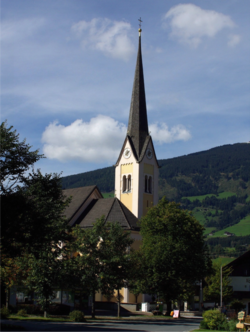 Hollersbach parish church | |
 Coat of arms | |
47°16′00″N 12°25′00″E / 47.26667°N 12.41667°E / 47.26667; 12.41667 | |
| Country | Austria |
| State | Salzburg |
| District | Zell am See |
| Government | |
| • Mayor | Günter Steiner (ÖVP) |
| Area | |
| • Total | 76.89 km2 (29.69 sq mi) |
| Elevation | 806 m (2,644 ft) |
| Population (2018-01-01)[2] | |
| • Total | 1,220 |
| • Density | 16/km2 (41/sq mi) |
| Time zone | UTC+1 (CET) |
| • Summer (DST) | UTC+2 (CEST) |
| Postal code | 5731 |
| Area code | 06562 |
| Vehicle registration | ZE |
| Website | www.hollersbach.salzburg.at |
Hollersbach im Pinzgau (Bavarian: Hoierschbouch an Pinzgau) is a municipality in the district of Zell am See (Pinzgau region), in the state of Salzburg in Austria. The population (as of May 2001) is 1159.
Overview
Yearly, in the end of September, it holds a festival that celebrates the time when the cows come down from the alps (where they stay during the warm seasons) to the stables in the city where they stay during the winter.
Economy
Its main economic activities are tourism and dairy farming.
In 2005 a cable-car that connects the city with the famous skiing region of Kitzbuehel was built, this brought a boost to real-estate in the municipality.
References
- v
- t
- e
Municipalities in the district of Zell am See
- Bramberg am Wildkogel
- Bruck an der Großglocknerstraße
- Dienten am Hochkönig
- Fusch an der Großglocknerstraße
- Hollersbach im Pinzgau
- Kaprun
- Krimml
- Lend
- Leogang
- Lofer
- Maishofen
- Maria Alm
- Mittersill
- Neukirchen am Großvenediger
- Niedernsill
- Piesendorf
- Rauris
- Saalbach-Hinterglemm
- Saalfelden
- St. Martin bei Lofer
- Stuhlfelden
- Taxenbach
- Unken
- Uttendorf
- Viehhofen
- Wald im Pinzgau
- Weißbach bei Lofer
- Zell am See
Authority control databases | |
|---|---|
| International |
|
| National |
|
 | This Salzburg state location article is a stub. You can help Wikipedia by expanding it. |
- v
- t
- e


