Edati
LGA in Niger State, Nigeria
9°03′N 5°39′E / 9.050°N 5.650°E / 9.050; 5.650 Nigeria
 (2006 census)
912

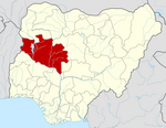
Edati is a Local Government Area in Niger State, Nigeria. Its headquarters are in the town of Enagi in the west of the area on the A124 highway at 9°08′00″N 5°33′00″E / 9.13333°N 5.55000°E / 9.13333; 5.55000. The LGA consists of two areas, separated by the Kaduna River. It has an area of 1,752 km2 and a population of 160,321 at the 2006 census.
The postal code of the area is 913.[1]
References
- ^ "Post Offices- with map of LGA". NIPOST. Archived from the original on 2009-10-07. Retrieved 2009-10-20.
- v
- t
- e
Niger StateState capital: Minna
 | This Niger State, Nigeria location article is a stub. You can help Wikipedia by expanding it. |
- v
- t
- e


