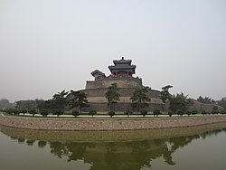
Congtai, Handan
District in Hebei, China
Congtai 丛台区 | |
|---|---|
District | |
 | |
| 36°38′11″N 114°29′34″E / 36.6364°N 114.4929°E / 36.6364; 114.4929 | |
| Country | China |
| Province | Hebei |
| Prefecture-level city | Handan |
| District seat | East Lianfang Subdistrict |
| Area | |
| • Total | 28 km2 (11 sq mi) |
| Elevation | 61 m (199 ft) |
| Population (2020 census)[1] | |
| • Total | 572,175 |
| • Density | 20,000/km2 (53,000/sq mi) |
| Time zone | UTC+8 (China Standard) |
| Postal code | 056004 |
| Website | www |
Congtai District (simplified Chinese: 丛台区; traditional Chinese: 叢台區; pinyin: Cóngtái Qū) is a district of the city of Handan, Hebei, China, with a population of 330,000[when?] residing in an area of just 28 km2 (11 sq mi).
The district seats the Handan's executive, legislature and judiciary, together with its Communist Party and Public Security bureaus.
Administration
The district comprises 10 subdistricts, 1 town and 4 townships.
- 10 subdistricts
- West Congtai Subdistrict (丛台西街道)
- West Lianfang Subdistrict (联纺西街道)
- East Lianfang Subdistrict (联纺东街道)
- Guangmingqiao Subdistrict (光明桥街道)
- East Congtai Subdistrict (丛台东街道)
- Sijiqing Subdistrict (四季青街道)
- Heping Subdistrict (和平街道)
- Zhonghua Subdistrict (中华街道)
- Renmin Road Subdistrict (人民路街道)
- Liulinqiao Subdistrict (柳林桥街道)
- 1 town
- Huangliangmeng Town (黄粱梦镇)
- 4 township
- Sucao Township (苏曹乡)
- Sanling Township (三陵乡)
- Nanlügu Township (南吕固乡)
- Jianzhuang Township (兼庄乡)
References
- ^ "公报!邯郸各县市区人口数来了!" (in Chinese). The Paper. 2021-06-07.
- v
- t
- e
County-level divisions of Hebei Province
cities
|
Authority control databases | |
|---|---|
| International |
|
| National |
|
 | This Handan location article is a stub. You can help Wikipedia by expanding it. |
- v
- t
- e


