Centenary Way
53°57′43″N 1°04′55″W / 53.962°N 1.082°W / 53.962; -1.082
and Filey, North Yorkshire
54°12′36″N 0°17′31″W / 54.210°N 0.292°W / 54.210; -0.292
The Centenary Way is a route devised to celebrate the 100th anniversary of North Yorkshire County Council. It was opened by Chris Brasher in 1989 to mark the Centenary of the governance by County Councils.
The route runs across the Howardian Hills and Yorkshire Wolds via Castle Howard and Wharram Percy, linking York and the Foss Walk with the Yorkshire Wolds Way and Cleveland Way National Trails.
Meeting the Derwent and Foss, the walk combines riverside walks in deep valleys with forest tracks. Part of the route overlaps with the Yorkshire Wolds Way which also ends at Filey along with the Cleveland Way.
Start: SE603522 – York, North Yorkshire
Finish: TA126817 – Filey Brigg, North Yorkshire
Waymark: Letters CW on standard waymarks
Places along the Centenary Way
The route of the Centenary Way passes close to or through the following places:
- York Minster
- Huntington
- New Earswick
- Strensall
- West Lilling
- Sheriff Hutton
- Terrington
- Slingsby
- Coneysthorpe
- Castle Howard
- Welburn
- Low Hutton
- Malton
- Norton
- Settrington
- North Grimston
- Birdsall
- Thixendale
- Wharram Percy
- Wintringham
- West Heslerton
- Sherburn
- Potter Brompton
- Ganton
- Hunmanby
- Filey
Places in italics are slightly off the main route.
Pictures
-
 Near Wintringham
 -
 Near Hunmanby
 -
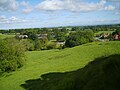 Near North Grimston


See also
References
- "Centenary Way (North Yorkshire)". Long Distance Walkers Association. Retrieved 16 December 2009.
Further reading
- The Centenary Way from Filey Brigg to York Minster
External links
Wikimedia Commons has media related to Centenary Way.
- Centenary Way North Yorkshire an overview of the walking route
- v
- t
- e
(England and Wales)
(England and Wales)
- Annandale Way
- Arran Coastal Way
- Ayrshire Coastal Path
- Berwickshire Coastal Path
- Borders Abbeys Way
- Cateran Trail
- Clyde Walkway
- Cross Borders Drove Road
- Dava Way
- Fife Coastal Path
- Formartine and Buchan Way
- Forth-Clyde/Union Canal Towpath
- Great Glen Canoe Trail
- Great Glen Way
- Great Trossachs Path
- John Muir Way
- Kintyre Way
- Loch Lomond and Cowal Way
- Moray Coast Trail
- Mull of Galloway Trail
- River Ayr Way
- Rob Roy Way
- Romans and Reivers Route
- St Cuthbert's Way
- Southern Upland Way
- Speyside Way
- Three Lochs Way
- West Highland Way
- West Island Way
(Northern Ireland)
 | This North Yorkshire location article is a stub. You can help Wikipedia by expanding it. |
- v
- t
- e


