Belén District, Sucre
District in Ayacucho, Peru
Belén District | |
|---|---|
District | |
 | |
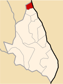 Location of Belen in the Sucre province | |
| Country |  Peru Peru |
| Department |  Ayacucho Ayacucho |
| Province | Sucre |
| Founded | November 23, 1964 |
| Capital | Belén |
| Subdivisions | 4 populated places |
| Government | |
| • Mayor | Julián Elías Cárdenas Pérez |
| Area | |
| • Total | 41.46 km2 (16.01 sq mi) |
| Elevation | 3,195 m (10,482 ft) |
| Population (2005 census) | |
| • Total | 611 |
| • Density | 15/km2 (38/sq mi) |
| Time zone | UTC-5 (PET) |
| UBIGEO | 050902 |
Belén is one of 11 districts of the Sucre Province in the Ayacucho region in Peru.
History
Belén District was created by Law No.15231 in Nov 23, 1964, during first term of President Fernando Belaúnde
Administrative division
The populated places in the district are:[1]
- Belen
- Socos
- Cochayocc
- Cuije
Population
The population of Belén is 611 people, 292 men and 319 women.[1]
Ethnic groups
The people in the district are mainly indigenous citizens of Quechua descent. Quechua is the language which the majority of the population (79.32%) learnt to speak in childhood, 20.52% of the residents started speaking using the Spanish language (2007 Peru Census).[2]
Authorities
Mayors
- 2011-2014: Julián Elías Cárdenas Pérez.
- 2007-2010: José Luis Romero Sheron.
Festivities
See also
References
- ^ a b INEI Archived 2007-06-01 at the Wayback Machine
- ^ inei.gob.pe Archived January 27, 2013, at the Wayback Machine INEI, Peru, Censos Nacionales 2007, Frequencias: Preguntas de Población: Idioma o lengua con el que aprendió hablar (in Spanish)
External links
- v
- t
- e

- Districts of Ayacucho Region
- Peru

13°48′34″S 73°45′24″W / 13.80944°S 73.75667°W / -13.80944; -73.75667
 | This Ayacucho Region geography article is a stub. You can help Wikipedia by expanding it. |
- v
- t
- e


