Archis, Armenia
41°09′51″N 44°52′21″E / 41.16417°N 44.87250°E / 41.16417; 44.87250
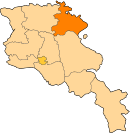
Place in Tavush, Armenia
Archis Արճիս | |
|---|---|
 | |
  Archis  Archis | |
| Coordinates: 41°09′51″N 44°52′21″E / 41.16417°N 44.87250°E / 41.16417; 44.87250 | |
| Country | Armenia |
| Province | Tavush |
| Municipality | Noyemberyan |
| Elevation | 750 m (2,460 ft) |
| Population (2011)[1] | |
| • Total | 1,125 |
| Time zone | UTC+4 (AMT) |
| Archis, Armenia at GEOnet Names Server | |
Archis (Armenian: Արճիս) is a village in the Noyemberyan Municipality of the Tavush Province of Armenia.
Gallery
-
 Scenery around Archis

References
- ^ Statistical Committee of Armenia. "The results of the 2011 Population Census of the Republic of Armenia" (PDF).
External links
Wikimedia Commons has media related to Archis, Armenia.
- World Gazeteer: Armenia[dead link] – World-Gazetteer.com
- Report of the results of the 2001 Armenian Census, Statistical Committee of Armenia
- v
- t
- e
 Tavush Province
Capital: Ijevan
- Ayrum
- Berd
- Dilijan
- Ijevan
- Noyemberyan
Portal:
 Geography


